


SILVIA (Sentinel-based Inference for Land Cover and Infiltration Analysis)
was born in response to massive changes in land use, from natural environments
to infrastructure. This transformation has impacted ecological functions, affected
environmental quality, and reduced the ability of soil to absorb water back into the aquifer.
This issue has become a global concern and is addressed by the United Nations in its
Sustainable Development Goals (SDGs), particularly SDG 6 (access to clean water and
sanitation) and SDG 15 (environmental quality and ecosystem life).
SILVIA is the result of research conducted by the Faculty of Information Technology at
Universitas Tarumanagara, published under the name of KJ Production, with a focus on observing land cover
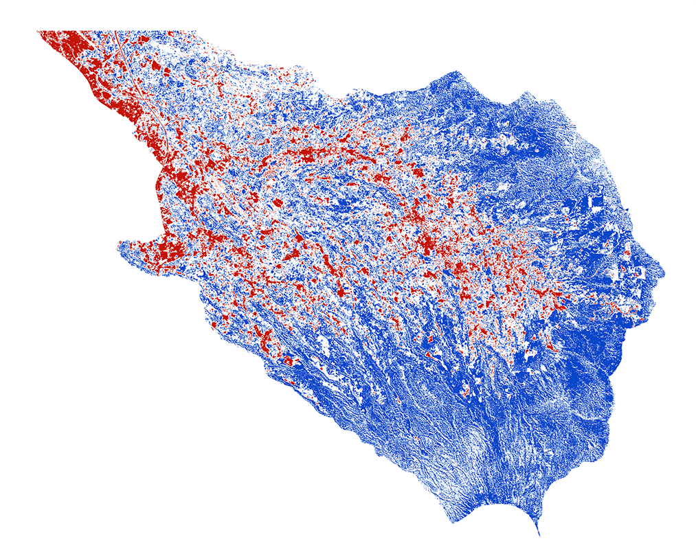
and the capacity of an area to absorb and store water. Based on machine learning using Kernel
Ridge Regression with Sentinel-2 data sources, SILVIA is capable of classifying land cover into
four categories as pervious, half-pervious, impervious, and water body, with an F1-score of up to 97.4%.
Further information regarding the SILVIA method can be accessed through a published scientific article in
here.
Data used in SILVIA is sourced from Sentinel-2 MSI Level-2A provided by Copernicus.
The research team of SILVIA wants to respond the Depok City Government's concerns about the depletion of
water in Depok, which is almost dry. Therefore, it is necessary to investigate the factors that contribute
to the depletion of water reserves.
In addition, the
BPS-Statistics Indonesia has reported that the decline in groundwater levels in Jakarta of 5-12
cm/year is also a concern because it is due to increasing water demand, but the water reserves in the aquifer
layer are not naturally replenished. There is an imbalance between demand and supply.
This condition has triggered a worsening clean water crisis, especially on the Java Island, which has experienced
a water deficit since 2010 and is projected to become even more critical in 2035, according to
BPS.

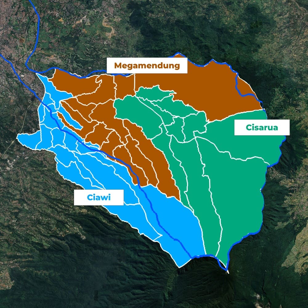
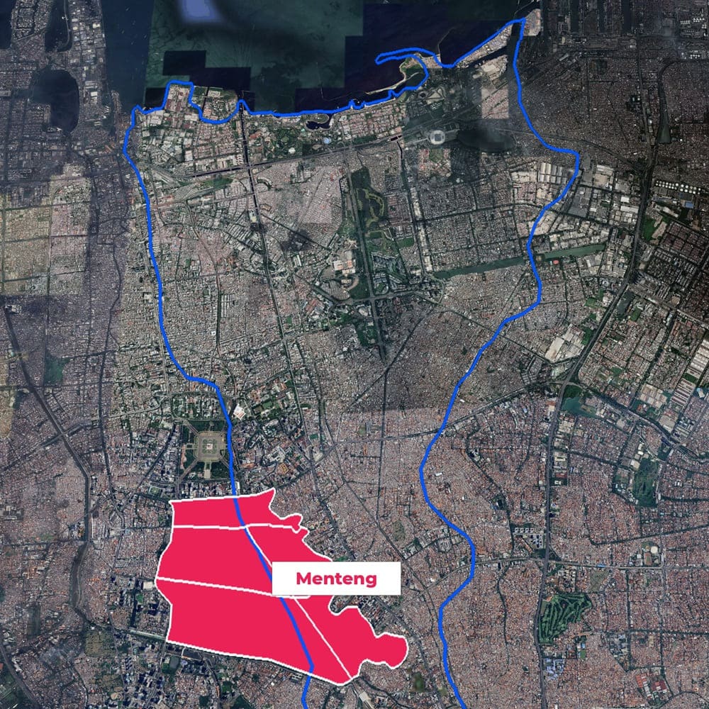
Based on these conditions, the research team concluded that the Ciliwung watershed is an important
element in the hydrological cycle in Jakarta and its surrounding areas. Originating in the mountainous
region of Bogor Regency, this watershed covers an area of ± 370.8 km² and flows northward to the coast
of Jakarta Bay, which is part of the Java Sea.
Among the 13 rivers that flow through Jakarta, the Ciliwung has the greatest impact because it crosses
the city center and passes through many densely populated areas, including villages, informal settlements,
and areas that are socially and ecologically vulnerable.
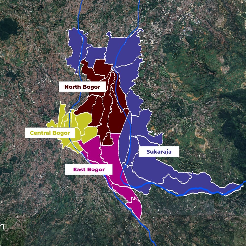
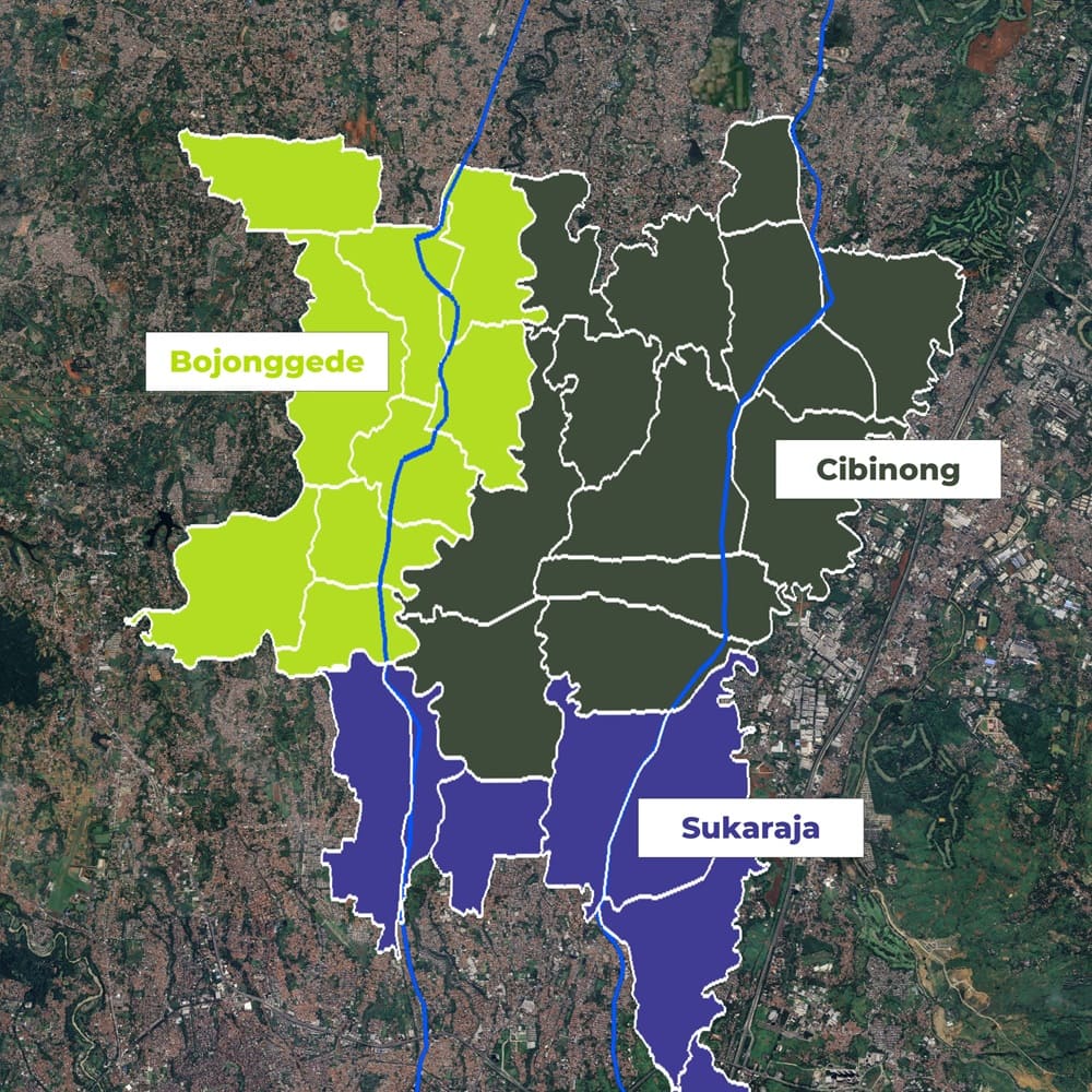
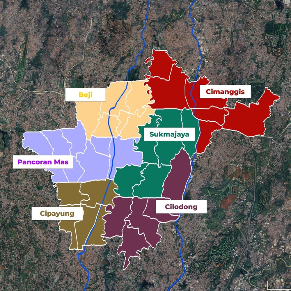
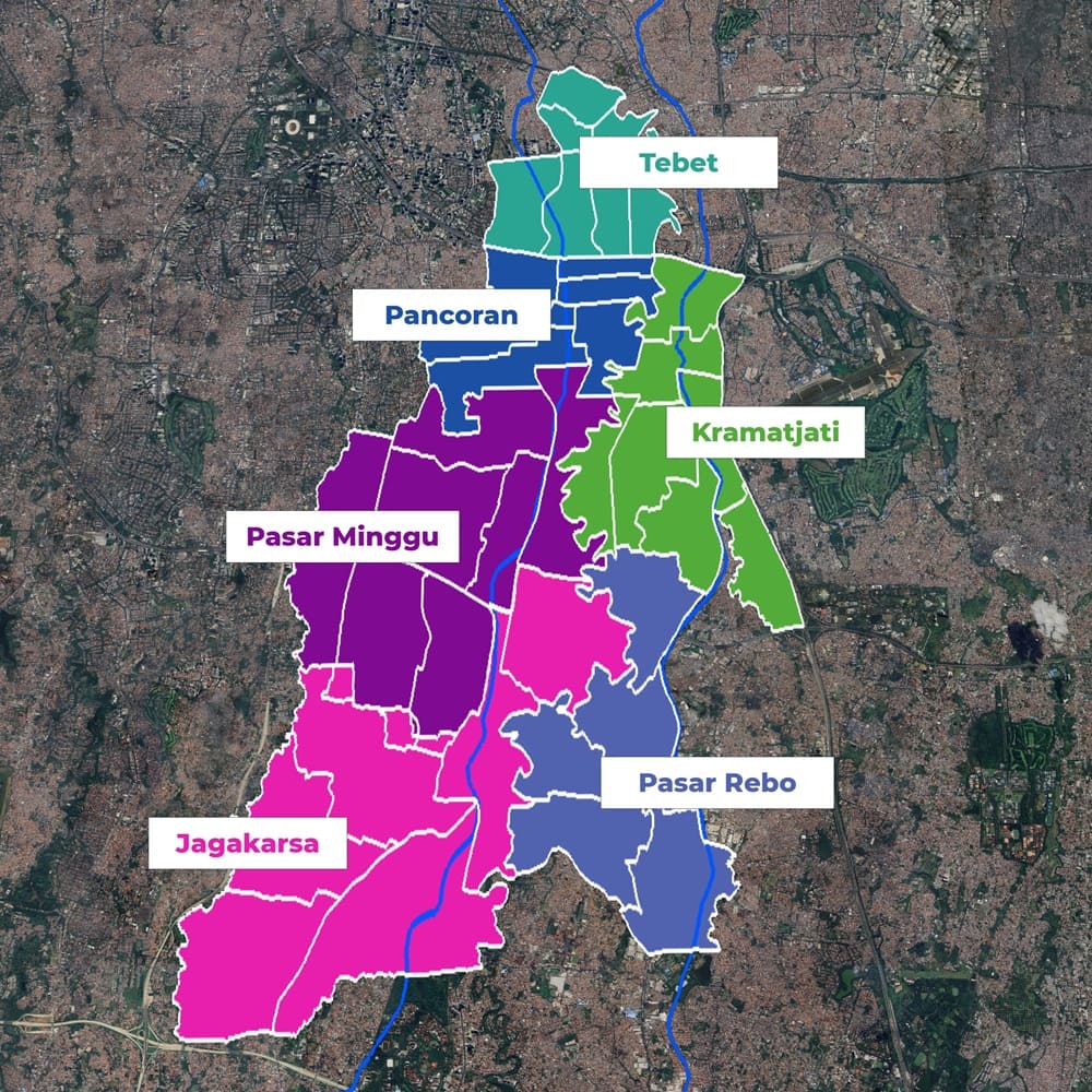
SILVIA was trained based on data from six segments of the Ciliwung watershed, as detailed on the left. In
the sixth segment, not all subdistricts were included due to the characteristics of the land, which is dominated
by built-up areas. However, SILVIA is designed to be used not only in the Ciliwung segment areas.
Nevertheless, further evaluation is needed for this because the characteristics of the actual field conditions outside the study
area may differ from the characteristics of the SILVIA training data, which could lead to inaccuracies.


Enjoy a 30-day free trial to try SILVIA. Simply register in
here, and the trial period will begin
once your access request is approved. Please ensure that the reason for your
access request is clearly stated.
If your free trial period ends and you would like to extend your access, our team will review
based on your use case and requirements. We do not guarantee that access extensions will be granted immediately.
SILVIA also provides various advanced features that can be customized according to your needs.
Integration with your systems or applications is easy to do through SILVIA Gateway, so
you can utilize data and analysis directly in your workflow.
"Just keep moving quitely until people think you can't do anything."
Since SILVIA was born at FTI Untar, we would like to thank everyone who contributed and made SILVIA possible, especially the management, lecturers, and employees at FTI Untar.
![]()

We are open to collaborating on further research, particularly in the field of
remote sensing, to enhance the performance and applicability of the model.
All inquiries, including collaboration and further exploration of use cases for
SILVIA, can be sent via email below.